Friday, May 26, 2006

Jackson Highway - Chehalis, Washington

Named for John R. Jackson, an early pioneer who settled in the area, this highway roughly follows what became an extension of the Oregon Trail for those wishing to venture farther north. Read about Jackson, see the old Jackson House and visit Lewis & Clark State Park. Access it from S. Market Blvd from Chehalis or Hwy 12 from I-5.


Not far south of Hwy 12 is the Jackson House. This well-preserved 1848 cabin served as the home of John R. Jackson and was the first "white-man" house north of Vancouver. Well worth a stop, if only for the history explained on the signs and stone posts at the gate. John Jackson settled here around 1844 and the house became a famous stopover on the trip north. It is said that the governor of Washington once stayed here while traveling to Olympia in 1854. The house also served as a courthouse for a time in the 1850's. Tours are available year-round by appointment. Call (360) 864-2643, or just take a peek in the windows.


Lewis and Clark State Park: Only 1.5 miles south of the Jackson House (see above) on the Jackson Hwy. is the entrance to the second park in the Washington State system (the Jackson House property was the first). Although named for the explorers, they did not get this far north. Learn instead about old growth forest and the Cowlitz Indians from interpretative signs in the park. Two interpretative trails with a total distance of about 1.5 miles (out and back) give excellent views of the one of the last stands of old growth forest in the lowlands of western Washington. If you want a longer walk, several trails loop off the main interpretative trail and a service road near the edge of the park offers a pleasant stroll that, together, can boost your hike to several miles. On the opposite side of the highway are equestrian trails. We cannot vouch for the condition of these trails at the moment because we did not try them out. The park is generally open April through September. If not officially open, park near (without blocking) the gate and walk along the entrance road for a short distance to the Trail of the Deer trailhead.

Tuesday, May 23, 2006

Stevens Pass Greenway, Washington

The formidible barrier of the Cascade Mountain Range has challenged transportation interests for many years. Railroad and highway builders, driven by commerce and the desire for people to get to the "other side," benefit us now with historical interest and recreation opportunities such as are found along modern Highway 2 in northern Washington. A beautiful drive itself, the highway also provides access to several points of interest along the way from Everett to Wenatchee. In nice weather, be sure to take a look at the western valley from the vantage point of the west side of Stevens Pass. The railroad is still there, but you may see that the route has significantly altered from former days!
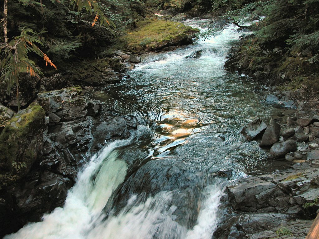

Deception Falls
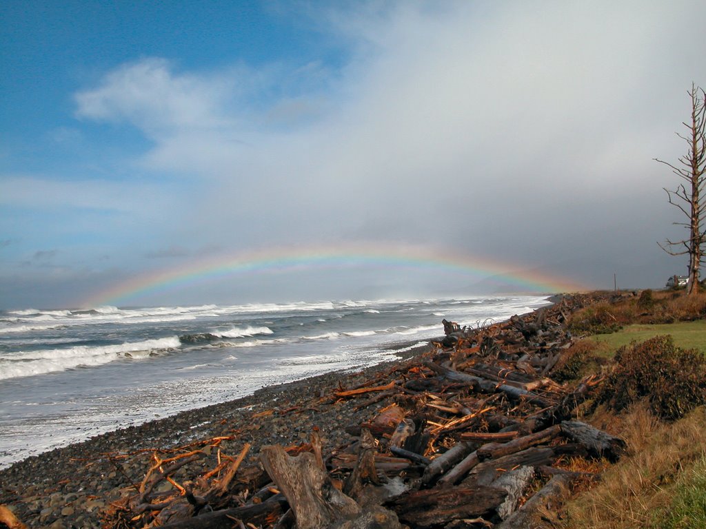
: Stand over the top of the raging water, walk under the highway for a view of the upper falls and enjoy a ½ mile interpretive nature trail. The parking lot is just off Highway 2 to the north and is signed--approximately 10 miles east of Skykomish. A covered picnic area offers a good spot for a family picnic and short hike. It’s worth a stop here just to see the Tye River make a 90 degree turn!


The Iron Goat Trail is where "rail history comes alive." A very nice hike even without the railroad remains and artifacts, you can enjoy natural beauty and the work of man together, with a potential walk of eleven miles on two trails. Look for old railroad tools and hardware along with some amazing structural remnants.

The trail's name refers to the Rocky Mountain goat that was the Great Northern Railway's logo.

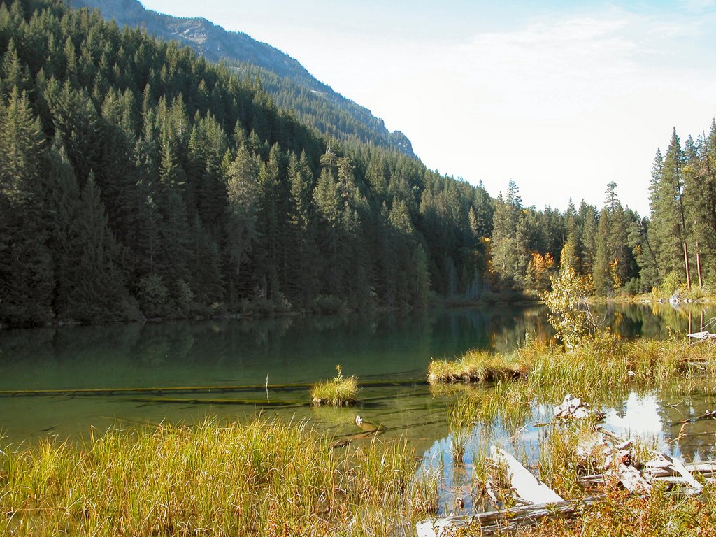
From US 2, turn north onto the Old Cascade Highway at Mile Post 55 or at Mile Post 58.4, USFS Road #67. This remnant of the old highway through the pass is a one lane paved road with nice views of the Tye River. Turn at the junction with gravel USFS Road #6710. Proceed 1.4 miles to the Martin Creek Trailhead parking lot. For more information and to access other trailheads, click here.


Bygone Byways: A pleasant, short loop made infinitely more interesting if you have the explanatory trail brochure. Points along the trail include a history of the efforts of man to tame nature to provide transportation through Stevens Pass by rail and road. Represented to be wheelchair accessible, but one area might be tough because of the narrowness of the way.

Right along side Hwy 2, this trail is only accessible while traveling west. The "exit" for the trail is signed, but really, the exit is merely an extra lane off the highway. A sign on the shoulder of the road marks the trailhead; it is just a few feet east of the sign. From Leavenworth, start your odometer after you pass the gas station on the corner of Icicle Road and Highway 2 West. Drive 20 miles west on Highway 2. On the right side of the Highway, look for the sign. Eastbound traffice should go past the Stevens Pass Nordic Center (5.7 miles from Stevens Pass) and continue on Highway 2 until it joins back up with westbound Highway 2. Turn around and follow Highway 2 West a short distance to the trailhead--look for the sign.


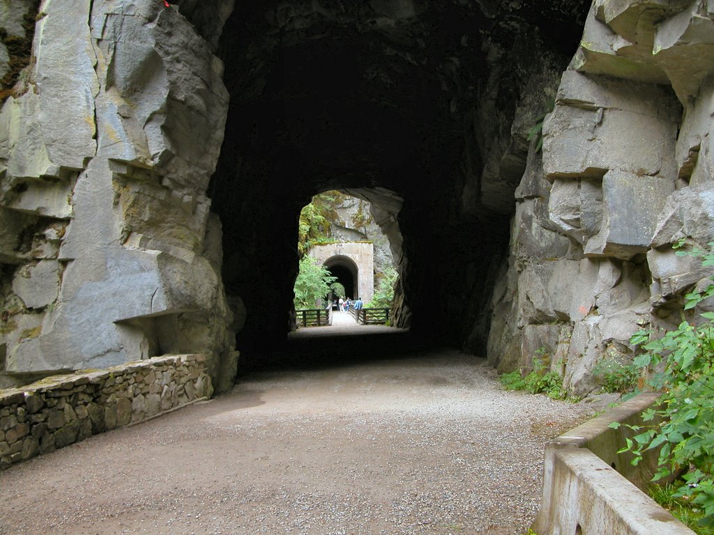
Walking down the trail, take the right fork when the trail splits. You soon come to an area marked with a signpost where the 1892 Great Northern Railroad crews blasted through solid rock to maintain the gentle grade that railroaders preferred. The gap seems barely wide enough for a train to go through. Emerging from the rock gap, look across the highway for a view of Jim Hill Mountain.

Follow the sign to stop #4, where you will see the remains of a stone oven. Railroad workers had to eat, and often, bread or even entire meals were cooked in these rock and earth ovens.

For a short loop, continue past #4 for a view point of Nason Creek. For the longer loop and closer view of the creek, retrace your steps back to stop #5 and continue down the hill to the remains of the old 1925 roadbed. Originally a packed earth and gravel surface, the moss has now taken over in a big way. Follow the trail around for views of the creek and the return to your car for a 1/2
mile loop.

Monday, May 22, 2006

Lake Wenatchee Area, Washington


A good hike for younger children (and even older ones) is the Hidden Lake Trail, #1510, south of Lake Wnatchee. From Highway 207, turn west on Cedar Brae Rd. For 2.6 miles, this road is paved, then travel .3 miles to where the road splits, veer left, following the sign to Glacier View Campground. The short road into the trailhead parking is signed. The trailhead parking is at GPS 47.49.298N, 120.48.205W.
The trail climbs perhaps 100 feet in .7 mile through the forest to a very nice clear, green lake surrounded by mountains. Wildlife includes rabbits, squirrels, chipmunks, woodpeckers, varied thrush and various waterfowl at the lake depending on the season. (We had a great view of a female common merganser.) Look for huckleberries in season. We’ve heard that "fishing is good if there aren’t too many people swimming."

Othello Tunnels, British Columbia


Railroad travel requires little comparative width, but the rail bed must be almost flat with no sudden vertical change. The necessity of such construction often required significant engineering feats, well illustrated in the construction of a railroad through the Coquihalla Canyon. The remains of this accomplishment of engineering make for a pleasant and fascinating walk near the town of Hope, B.C.

To view the tunnels and trestles of this daring endeavor to join the coast and the interior, travel east on Highway 1 to the town of Hope, following Highway 1 where it branches away from Highway 3. Turn right on the Old Hope-Princeton Highway briefly, then left on 6th Ave. Take the next right, the Kawkawa Lake Road (don’t miss it by looking to the left, where the road has a different name). In under 2 miles, at a major fork, take the right fork onto Othello Road. Follow that for approximately two more miles, and turn right on Tunnel Road (look for the signs for the Othello Tunnels). Tunnel Road ends in a parking lot, where you will pay a parking fee of $3. Vandalism is a problem in this area, so be sure to take your valuables or put them out of sight. 

An easy stroll through the tunnels, over the trestles and back is only 1.2 miles, but may take an hour or more as you stop to read signs about the railroad and admire the work of both man and nature.

If you are ready for more exercise and more history, hike the Hope-Nicola Valley trail as well, for a loop trip of around 5 miles. To reach the Hope-Nicola trail, walk past the last tunnel until just after a yellow gate across the old railroad bed. There, turn right up a trail that climbs steeply to the northeast, and then swings around to the northwest in a gentler climb. An open area provides a view of the highway across the river and you may spot an osprey nest perched at the top of a tall tree trunk. At the summit, a small plaque on a tree describes the history of the trail.

Start downhill from here. The vegetation encroaches over the trail in places and you may wonder if it will peter out. It doesn’t. Keep downhill until you reach a t-intersection with a sign indicating the Hope-Nicola Valley trail and turn right. You will reach a small clearing, stay to the right again. Emerge onto an old road, also signed for the Hope-Nicola Valley trail. (GPS 49.22.882 N, 121.22.142 W) Turn right here for a gentle descent to Tunnel Road, turn right and walk along the road to your car.

Pacific City, Oregon Coast


Although most Oregonians have heard of it, this is possibly one of the least visited areas on the north coast. Maybe that's because you actually have to turn off Highway 101 to get there! As a result, I think of this area as less of a tourist trap than say, Cannon Beach or Seaside. If you go to the coast to shop...probably not your first choice. But if you want solitude and natural beauty, give these places a try.

Whalen Island: A pleasant 1.4 mile loop hike with little elevation gain and several view opportunities of the Sandlake Estuary. From Sandlake Rd., look for the sign for Whalen Island Park. Cross the bridge into the park and veer right to the Clay Myers Natural Area. Park near the restrooms and picnic tables.
Begin either from the north or south edges of the parking lot to follow the loop trail. To the south is an accessible trail to an estuary overlook .1 mile over gravel. The remainder of the trail is dirt and sand. Also to the north is an estuary viewing location, but binoculars, or better yet, a scope is necessary to identify the bird life bobbing in the water.

You may see bufflehead, loons, cormorants, mergansers, blue heron, great egret and on our last visit, we were favored with a fly-by of a bald eagle.

Sandlake Recreation Area: Although dominated by OHV lovers, the other side of the estuary is viewable from your vehicle at the day-use area of Sand Beach Campground. From Sandlake Rd., turn on Galloway Rd. and follow the signs to Sandlake Recreation Area. Turn left toward the campground, but instead of entering the campground, continue straight ahead to a parking lot with a view of the estuary. Again, a nice place to set up a spotting scope.

Bob Straub Wayside: Want to drive on the beach? On Pacific Ave. in Pacific City. Look for the sign.

Bob Straub State Park provides access to the Nestucca Spit. From Pacific Ave. turn left on Sunset Drive. Follow this road until it ends in a parking lot. Head over the dune and turn south (left) along the beach about 2.3 miles to the end of the spit, watching out for vehicles, which are allowed on the beach here. We saw a big group of seals lounging on the sand at the end of the spit. Round the tip of the spit and walk northeast along the shore of Nestucca Bay. At about 1.5 miles, the shoreline ends in a marshy, slough-infested area make any further northerly movement difficult. At this point, look for a sandy path through the young forest going in a generally westerly direction. This trail winds through the forest until it comes to a wider path that goes generally north. It is a good idea to have a compass or GPS in this area, because the woods are thick and horse trails crisscross through the forest. Also note that during the winter, some of the trail may be under water and will require some bushwacking to get through. Continue north until you return to the parking lot from whence you began.