Wednesday, June 28, 2006

Mosier Tunnels, Columbia Gorge, Oregon


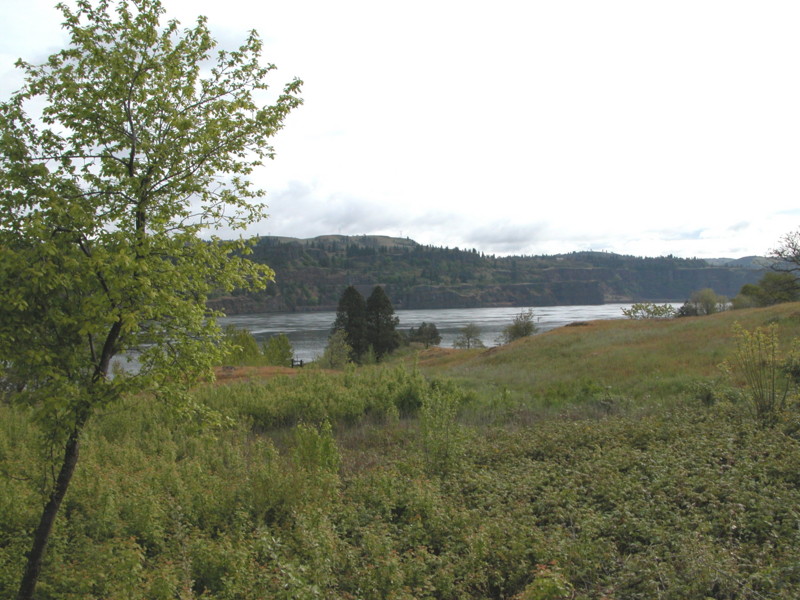
Built on a section of the old Columbia River Highway, this paved path remarkably illustrates the transition from the damp west side of the Cascades to the drier, east side. Both walkers and bicyclists enjoy this trail. In early spring, bring your wildflower field guide.

At its west end, at the edge of the town of Hood River, the trail begins in lush forest, mossy and green. The freeway noise is somewhat disturbing but easily forgotten when you view the old arched stone guard rails of the road. Soon the trail passes behind a basalt bluff and the freeway noise disappears. A small pond at the foot of the rock wall holds the occasional water fowl, including, on one visit, a pair of wood ducks.

At about the 3.5 mile mark, a huge concrete structure shelters the path, built to protect pedestrians and bikers from falling rock from the edge of the cliff. At the eastern edge of this structure are the twin tunnels, which have been restored from the originals built for the old highway. Arched stone entrances and timbered interiors, the two tunnels were engineering marvels at the time of their original construction. As the size of vehicles increased, it became more and more dangerous to venture through the limited interior space. A signal light was eventually added so that one way traffic could flow through safely, but wo unto those waiting at the signal! Ever present was the possibility that rocks falling from the cliff would really ruin your day.

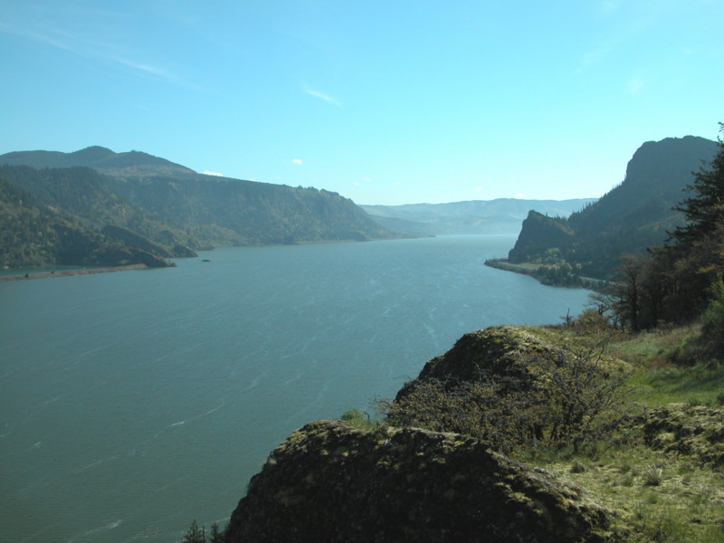
The highway eventually moved to river level and the tunnels were backfilled until their recent restoration. Now they are a marvelous sight for the hiker and biker, right down to the etchings of snowbound travelers into the rock wall. Breeze through the tunnels and there on the other side, the smells of eastern Oregon assail you. A stone lookout to the north of the path provides a spectacular view, and a dry and warm place to have lunch. Turkey vultures float by on the thermals coming up from below. Eastern Oregon birds, like the Says Phoebe and Lazuli Bunting pop by.

From the lookout, begin a steep descent for the last mile to the eastern parking lot near Mosier. After taking brief look at what appears to be a giant rock quarry, return for the steep ascent. Our trip back became a bit endurance, but we finished the 9.2 mile round trip with enough energy to drive to The Dalles for dinner and a milkshake.

To get to the west trailhead, leave I-84 at exit 64. Follow "Goverment Camp" signs .3 mile to a stop sign and turn left onto Old Columbia River Drive. Follow the road as it winds up the hill until it ends in a parking lot with a visitor's center.

Tuesday, June 27, 2006

Wygant Trail, Columbia Gorge, Oregon


Friday dawns cool and overcast, but we are prepared for rain. From Memaloose State Park, we head back west to the trail of choice for the day. We arrive at the parking lot at Mitchell Point, which is bathed in sunlight from a blue break in the clouds. The light from the rising sun leaks over the top of the tower of rock straight ahead of us, causing a glow in the haze that still hangs in the air.

We take a look from the edge of the parking lot positioned over the freeway. The sunlight through that growing cloud break becomes more brilliant as the sun creeps closer to the top of our rock tower. Finally, we turn toward the trail and begin the official hike.

The trail ducks down into the woods where the surface soon turns from dirt to a section of the old Columbia River Highway. We comment on how well the pavement has withstood the time. Covered with moss and needles, it could just be brushed off and put back to use.

Returning to a dirt trail, we start to climb. The trail is narrower than many others in the Gorge—it seems that this trail does not get as much use. Plenty of poison oak surrounds us. We come to an area where power lines cut through and there, on top of one of the electrical towers is a huge osprey nest housing two osprey. The trail then crosses a creek on a log and board foot bridge and continues upward. We arrive at a point 300 feet above the freeway and stare down at the passing vehicles. We are promised a better view if we keep on, so we continue and reach a ridge at the 1350 foot elevation where we can see up and down the Gorge for miles. Because of lingering clouds, we cannot see the promised view of Mt. Adams.

The trail loops around to the south to join the Chetwoot (“black bear” in Chinook) Trail, which is even more roughly maintained and overgrown. We finally reach the bottom of Perham Creek Canyon, where we must scramble over the creek holding onto branches that spread across it. Waterproof hiking boots help here.

Back up for awhile, but soon ever downward as we descend back to our beginning. My toes ache from the pressure of sliding up against my boots. We reach the bottom after an enjoyable 6.1 miles. We never saw a single soul the entire time we were on the trail.

Memaloose State Park, Columbia Gorge, Oregon


Located between I-84 and railroad tracks in the normally windy gorge, and difficult to get to from the west, Memaloose State Park might not seem like the ideal place to camp. While it is true that passing train whistles wake you from a sound slumber and the white noise of freeway traffic is ever present, a blue and salmon glow on the river at sunset may change your mind about stopping. Perched on the bank overlooking the Columbia River, history, geology and fantastic river views are yours. You could do worse.

We left on a Thursday in early spring, making our way eastbound through the city of Portland and post-rush hour traffic. Once we left the city behind, our ribbon of gray cut through the trees, forest and grasslands of the Columbia Gorge. Ever present to the left is the mighty river. Occasional raindrops splash the windshield, but we are undeterred because our destination is the edge of the more arid east side of the Cascade Mountains. The area surrounding this grassy, shaded campground is a change from the mossy green to which we are accustomed.

Arriving without a reservation, we were able to snag a prime campsite overlooking the river. Across the gray waters, sloping up from the bank on the other side, ancient lava flows, hardened into towers of basalt, provide shelter for the green grasses and wildflowers of spring. Closer to home, a wildly flowering hawthorne just 10 feet from the rear of our campsite looked like an explosion of green and white.

Also visible from the park is a granite monument marking the final resting place of a local pioneer, Victor Trevitt, on Memaloose Island. He is not alone there. When Lewis and Clark passed by, Clark called the island “Sepulchar Island” because of Indian use of the island as a burial place. The Chinook Indians tribes laid the bones of their dead on open pyres on the island.

If you tire of the views from camp, try a nearby hike or drive into town for a look at the Columbia Gorge hotel, with its secret waterfall.

To get to Memaloose State Park drive I-84 about 70 miles from Portland or 11 miles from The Dalles. When arriving from the west, follow the signs, which will require some backtracking on the freeway.