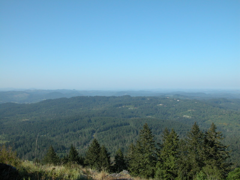
First, let me say that, on a clear day, the view is spectacular. But the getting there, well...
One of my favorite guidebook authors rated this hike as “easy.” He must be thinking this is some kind of funny joke. One muscular young man with a full backpack passed us on the trail–he’s training to climb Mt. Ranier. On the other hand, as we paused at the top to enjoy the view (and catch our breath), along came 84-year-old Stuart, leaning heavily on his trekking poles.
So you decide: “easy” enough for an 84-year-old or mountain climbing training. I will suggest that you do not do this hike on a rainy day. The .7 mile trail up 800 feet is steep, dirty and requires scrambling over bare rock faces, in other words, slippery when wet. Besides, the view from the top–the great reward for all this effort–would be minimal anyway.
From downtown Eugene, drive 5 miles south on Willamette Street. Look for a three-log-post sign for Spencer Butte Park on the left. From the parking lot, climb the concrete stairs. We started out on the left fork, but the trail is a loop so pick your poison (if you want to take the Ridgeline Trail later, start out to the left as we did). The main trail is difficult to follow because of the many shortcuts attempted by your predecessors, but if you follow the wooden stair steps, always continuing up, you can’t go too wrong. Once you reach the top, you’ll know it by the 360 degree view and the forest of poison oak.
To return on the loop, veer south, descending on the east side of the summit. Again, the main trail down is tough to find because of the many variations, but if you get confused, just ask one of the many other folk who will probably be climbing up toward you.
We also took the Ridgeline Trail because we didn’t wear ourselves out on the climb. Look for a signed junction in a small meadow about .5 mile from the top. Unless you have a shuttle, this portion is an out-and-back and descends another 300 feet. A nice way to get some more exercise, the highlight of this extension for us was the pileated woodpecker busily pounding on a downed log right next to the trail.
