Tuesday, September 12, 2006

Palouse Falls State Park, Southeast Washington


Like discovering a shiny jewel in a pile of rocks, the 198-foot Palouse Falls surprises not only in its beauty but also in location. Among brown and gold rolling hills in the southeastern Washington desert, the water edge and canyon walls display thriving green.

The powerful falls you see are but a trickle compared to the giant floods scientists believe roared through here some 15,000 years ago. Ice age glaciers dammed the Clark Fork River in Montana, forming glacial Lake Missoula. At its peak, the lake may have been 2,000 feet deep (about the depth of Crater Lake) and spanned 3,000 square miles. The breach of the colossal ice dam sent a wall of water pouring through southeast Washington, scouring all the top soil and ripping deep channels in the volcanic basalt. The flood water roared through the Columbia Gorge and leaked into the Willamette Valley. This was not a one-time event, according to scientists, but occurred repeatedly as the dam formed and breached–-as many as 90 times.

As you gaze down at the chasm into which the falls plunge, you realize that there is simply not enough water there to make a hole that big. The scientific explanation makes some sense–even to the casual observer–but is not without controversy. Apparently, many geologists have a basic aversion to catastrophic events, believing instead that geological change result from slow and steady processes.

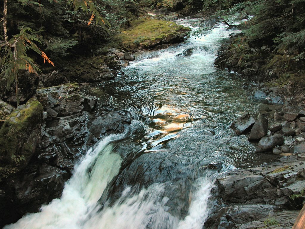
Ponder the controversy as you explore the area in several directions. One trail goes down the side of the cliff to the splash pool at the bottom of the falls, where we saw several young men fishing. Another trail leads to an Eden-like area of gentle cataracts surrounded by vegetation. Continuing on from this area takes you to the very top of the falls and the stone “castle.”

In the heat of summer, the grounds at the state park are an oasis of green and trees to which birds and other wildlife gather. Camping is permitted in the state park and we backed our trailer up to the grass, spending quiet nights all alone there in July. In the morning, the squeaky chatter of the western kingbirds and Bullocks orioles acted as an alarm clock. During summer days you will also likely see swallows, swifts and wildflowers. If you don’t want to camp, you might enjoy a picnic here on the grass to fortify you for a hike.

To get there, head toward the Tri-Cities. From Highway 395, go east on State Route 26 twenty two miles to Washtucna. Turn south on SR 261 fifteen miles to the turnoff for the state park. If you are as fascinated as we were with the whole idea of the Ice Age Floods, take a look at the information on the Ice Age Institute’s website.

Tuesday, August 15, 2006

Spencer Butte, Eugene, Oregon


First, let me say that, on a clear day, the view is spectacular. But the getting there, well...

One of my favorite guidebook authors rated this hike as “easy.” He must be thinking this is some kind of funny joke. One muscular young man with a full backpack passed us on the trail–he’s training to climb Mt. Ranier. On the other hand, as we paused at the top to enjoy the view (and catch our breath), along came 84-year-old Stuart, leaning heavily on his trekking poles.

So you decide: “easy” enough for an 84-year-old or mountain climbing training. I will suggest that you do not do this hike on a rainy day. The .7 mile trail up 800 feet is steep, dirty and requires scrambling over bare rock faces, in other words, slippery when wet. Besides, the view from the top–the great reward for all this effort–would be minimal anyway.

From downtown Eugene, drive 5 miles south on Willamette Street. Look for a three-log-post sign for Spencer Butte Park on the left. From the parking lot, climb the concrete stairs. We started out on the left fork, but the trail is a loop so pick your poison (if you want to take the Ridgeline Trail later, start out to the left as we did). The main trail is difficult to follow because of the many shortcuts attempted by your predecessors, but if you follow the wooden stair steps, always continuing up, you can’t go too wrong. Once you reach the top, you’ll know it by the 360 degree view and the forest of poison oak.

To return on the loop, veer south, descending on the east side of the summit. Again, the main trail down is tough to find because of the many variations, but if you get confused, just ask one of the many other folk who will probably be climbing up toward you.

We also took the Ridgeline Trail because we didn’t wear ourselves out on the climb. Look for a signed junction in a small meadow about .5 mile from the top. Unless you have a shuttle, this portion is an out-and-back and descends another 300 feet. A nice way to get some more exercise, the highlight of this extension for us was the pileated woodpecker busily pounding on a downed log right next to the trail.

Monday, August 07, 2006

The Tommy Thompson Trail Anacortes, Washington


Another great rails-to-trails success, the best part of this just-over-three mile path is the final two miles. If you are on a bike, go ahead, do it all. From I-5, go west on Highway 20 toward Anacortes. Drive into Anacortes on the Highway 20 spur and turn right into the Safeway parking lot near 12th St. Unload your bike, cross Q St and turn right on the paved path.

If you are on your feet, you may want to skip the first mile or so that travels through an industrial area. For the “best” two mile stretch, travel toward Anacortes, turn right on R St. and take the first right onto 34th St. After .3 mile, just before the road begins to curve left, look for the trail on either side of the street. Park at the curb and head away from the huge boat construction building and toward Fidalgo Bay.

The trail here soon parallels the shore of the bay, while salmonberries, blackberries and other vegetation climb the hill to your right. Take a look on top of the pilings and in the water for pelagic cormorants. We spotted a lone California quail perched on the fence of the only residence along this stretch of the path. Mt. Baker may be visible, depending on the weather.

After a mile, you will pass through the Fidalgo Bay RV Resort and then start out the Weaverling Spit. On your left is a woodsy expanse in which firs and madrone harbor song sparrows, cedar waxwings, and chestnut-backed chickadees. If thistle is in bloom, watch for the bright yellow American goldfinch. Several plants have taken hold in the rocky sides of the spit and you will see wildflowers into July.

Soon you reach the highlight of the trip, the old 2000-foot railroad trestle, overlaid with new decking, across Fidalgo Bay. You might spot kingfishers, heron or western sandpipers waiting on the rocks for the tide to go out. Benches on the spit and trestle offer a place to sit a spell and soak up the scenery. The path ends at the east shore of the bay.

Wednesday, June 28, 2006

Mosier Tunnels, Columbia Gorge, Oregon


Built on a section of the old Columbia River Highway, this paved path remarkably illustrates the transition from the damp west side of the Cascades to the drier, east side. Both walkers and bicyclists enjoy this trail. In early spring, bring your wildflower field guide.

At its west end, at the edge of the town of Hood River, the trail begins in lush forest, mossy and green. The freeway noise is somewhat disturbing but easily forgotten when you view the old arched stone guard rails of the road. Soon the trail passes behind a basalt bluff and the freeway noise disappears. A small pond at the foot of the rock wall holds the occasional water fowl, including, on one visit, a pair of wood ducks.

At about the 3.5 mile mark, a huge concrete structure shelters the path, built to protect pedestrians and bikers from falling rock from the edge of the cliff. At the eastern edge of this structure are the twin tunnels, which have been restored from the originals built for the old highway. Arched stone entrances and timbered interiors, the two tunnels were engineering marvels at the time of their original construction. As the size of vehicles increased, it became more and more dangerous to venture through the limited interior space. A signal light was eventually added so that one way traffic could flow through safely, but wo unto those waiting at the signal! Ever present was the possibility that rocks falling from the cliff would really ruin your day.

The highway eventually moved to river level and the tunnels were backfilled until their recent restoration. Now they are a marvelous sight for the hiker and biker, right down to the etchings of snowbound travelers into the rock wall. Breeze through the tunnels and there on the other side, the smells of eastern Oregon assail you. A stone lookout to the north of the path provides a spectacular view, and a dry and warm place to have lunch. Turkey vultures float by on the thermals coming up from below. Eastern Oregon birds, like the Says Phoebe and Lazuli Bunting pop by.

From the lookout, begin a steep descent for the last mile to the eastern parking lot near Mosier. After taking brief look at what appears to be a giant rock quarry, return for the steep ascent. Our trip back became a bit endurance, but we finished the 9.2 mile round trip with enough energy to drive to The Dalles for dinner and a milkshake.

To get to the west trailhead, leave I-84 at exit 64. Follow "Goverment Camp" signs .3 mile to a stop sign and turn left onto Old Columbia River Drive. Follow the road as it winds up the hill until it ends in a parking lot with a visitor's center.

Tuesday, June 27, 2006

Wygant Trail, Columbia Gorge, Oregon


Friday dawns cool and overcast, but we are prepared for rain. From Memaloose State Park, we head back west to the trail of choice for the day. We arrive at the parking lot at Mitchell Point, which is bathed in sunlight from a blue break in the clouds. The light from the rising sun leaks over the top of the tower of rock straight ahead of us, causing a glow in the haze that still hangs in the air.

We take a look from the edge of the parking lot positioned over the freeway. The sunlight through that growing cloud break becomes more brilliant as the sun creeps closer to the top of our rock tower. Finally, we turn toward the trail and begin the official hike.

The trail ducks down into the woods where the surface soon turns from dirt to a section of the old Columbia River Highway. We comment on how well the pavement has withstood the time. Covered with moss and needles, it could just be brushed off and put back to use.

Returning to a dirt trail, we start to climb. The trail is narrower than many others in the Gorge—it seems that this trail does not get as much use. Plenty of poison oak surrounds us. We come to an area where power lines cut through and there, on top of one of the electrical towers is a huge osprey nest housing two osprey. The trail then crosses a creek on a log and board foot bridge and continues upward. We arrive at a point 300 feet above the freeway and stare down at the passing vehicles. We are promised a better view if we keep on, so we continue and reach a ridge at the 1350 foot elevation where we can see up and down the Gorge for miles. Because of lingering clouds, we cannot see the promised view of Mt. Adams.

The trail loops around to the south to join the Chetwoot (“black bear” in Chinook) Trail, which is even more roughly maintained and overgrown. We finally reach the bottom of Perham Creek Canyon, where we must scramble over the creek holding onto branches that spread across it. Waterproof hiking boots help here.

Back up for awhile, but soon ever downward as we descend back to our beginning. My toes ache from the pressure of sliding up against my boots. We reach the bottom after an enjoyable 6.1 miles. We never saw a single soul the entire time we were on the trail.

Memaloose State Park, Columbia Gorge, Oregon


Located between I-84 and railroad tracks in the normally windy gorge, and difficult to get to from the west, Memaloose State Park might not seem like the ideal place to camp. While it is true that passing train whistles wake you from a sound slumber and the white noise of freeway traffic is ever present, a blue and salmon glow on the river at sunset may change your mind about stopping. Perched on the bank overlooking the Columbia River, history, geology and fantastic river views are yours. You could do worse.

We left on a Thursday in early spring, making our way eastbound through the city of Portland and post-rush hour traffic. Once we left the city behind, our ribbon of gray cut through the trees, forest and grasslands of the Columbia Gorge. Ever present to the left is the mighty river. Occasional raindrops splash the windshield, but we are undeterred because our destination is the edge of the more arid east side of the Cascade Mountains. The area surrounding this grassy, shaded campground is a change from the mossy green to which we are accustomed.

Arriving without a reservation, we were able to snag a prime campsite overlooking the river. Across the gray waters, sloping up from the bank on the other side, ancient lava flows, hardened into towers of basalt, provide shelter for the green grasses and wildflowers of spring. Closer to home, a wildly flowering hawthorne just 10 feet from the rear of our campsite looked like an explosion of green and white.

Also visible from the park is a granite monument marking the final resting place of a local pioneer, Victor Trevitt, on Memaloose Island. He is not alone there. When Lewis and Clark passed by, Clark called the island “Sepulchar Island” because of Indian use of the island as a burial place. The Chinook Indians tribes laid the bones of their dead on open pyres on the island.

If you tire of the views from camp, try a nearby hike or drive into town for a look at the Columbia Gorge hotel, with its secret waterfall.

To get to Memaloose State Park drive I-84 about 70 miles from Portland or 11 miles from The Dalles. When arriving from the west, follow the signs, which will require some backtracking on the freeway.

Friday, May 26, 2006

Jackson Highway - Chehalis, Washington

Named for John R. Jackson, an early pioneer who settled in the area, this highway roughly follows what became an extension of the Oregon Trail for those wishing to venture farther north. Read about Jackson, see the old Jackson House and visit Lewis & Clark State Park. Access it from S. Market Blvd from Chehalis or Hwy 12 from I-5.


Not far south of Hwy 12 is the Jackson House. This well-preserved 1848 cabin served as the home of John R. Jackson and was the first "white-man" house north of Vancouver. Well worth a stop, if only for the history explained on the signs and stone posts at the gate. John Jackson settled here around 1844 and the house became a famous stopover on the trip north. It is said that the governor of Washington once stayed here while traveling to Olympia in 1854. The house also served as a courthouse for a time in the 1850's. Tours are available year-round by appointment. Call (360) 864-2643, or just take a peek in the windows.


Lewis and Clark State Park: Only 1.5 miles south of the Jackson House (see above) on the Jackson Hwy. is the entrance to the second park in the Washington State system (the Jackson House property was the first). Although named for the explorers, they did not get this far north. Learn instead about old growth forest and the Cowlitz Indians from interpretative signs in the park. Two interpretative trails with a total distance of about 1.5 miles (out and back) give excellent views of the one of the last stands of old growth forest in the lowlands of western Washington. If you want a longer walk, several trails loop off the main interpretative trail and a service road near the edge of the park offers a pleasant stroll that, together, can boost your hike to several miles. On the opposite side of the highway are equestrian trails. We cannot vouch for the condition of these trails at the moment because we did not try them out. The park is generally open April through September. If not officially open, park near (without blocking) the gate and walk along the entrance road for a short distance to the Trail of the Deer trailhead.

Tuesday, May 23, 2006

Stevens Pass Greenway, Washington

The formidible barrier of the Cascade Mountain Range has challenged transportation interests for many years. Railroad and highway builders, driven by commerce and the desire for people to get to the "other side," benefit us now with historical interest and recreation opportunities such as are found along modern Highway 2 in northern Washington. A beautiful drive itself, the highway also provides access to several points of interest along the way from Everett to Wenatchee. In nice weather, be sure to take a look at the western valley from the vantage point of the west side of Stevens Pass. The railroad is still there, but you may see that the route has significantly altered from former days!


Deception Falls: Stand over the top of the raging water, walk under the highway for a view of the upper falls and enjoy a ½ mile interpretive nature trail. The parking lot is just off Highway 2 to the north and is signed--approximately 10 miles east of Skykomish. A covered picnic area offers a good spot for a family picnic and short hike. It’s worth a stop here just to see the Tye River make a 90 degree turn!


The Iron Goat Trail is where "rail history comes alive." A very nice hike even without the railroad remains and artifacts, you can enjoy natural beauty and the work of man together, with a potential walk of eleven miles on two trails. Look for old railroad tools and hardware along with some amazing structural remnants.

The trail's name refers to the Rocky Mountain goat that was the Great Northern Railway's logo.

From US 2, turn north onto the Old Cascade Highway at Mile Post 55 or at Mile Post 58.4, USFS Road #67. This remnant of the old highway through the pass is a one lane paved road with nice views of the Tye River. Turn at the junction with gravel USFS Road #6710. Proceed 1.4 miles to the Martin Creek Trailhead parking lot. For more information and to access other trailheads, click here.


Bygone Byways: A pleasant, short loop made infinitely more interesting if you have the explanatory trail brochure. Points along the trail include a history of the efforts of man to tame nature to provide transportation through Stevens Pass by rail and road. Represented to be wheelchair accessible, but one area might be tough because of the narrowness of the way.

Right along side Hwy 2, this trail is only accessible while traveling west. The "exit" for the trail is signed, but really, the exit is merely an extra lane off the highway. A sign on the shoulder of the road marks the trailhead; it is just a few feet east of the sign. From Leavenworth, start your odometer after you pass the gas station on the corner of Icicle Road and Highway 2 West. Drive 20 miles west on Highway 2. On the right side of the Highway, look for the sign. Eastbound traffice should go past the Stevens Pass Nordic Center (5.7 miles from Stevens Pass) and continue on Highway 2 until it joins back up with westbound Highway 2. Turn around and follow Highway 2 West a short distance to the trailhead--look for the sign.


Walking down the trail, take the right fork when the trail splits. You soon come to an area marked with a signpost where the 1892 Great Northern Railroad crews blasted through solid rock to maintain the gentle grade that railroaders preferred. The gap seems barely wide enough for a train to go through. Emerging from the rock gap, look across the highway for a view of Jim Hill Mountain.

Follow the sign to stop #4, where you will see the remains of a stone oven. Railroad workers had to eat, and often, bread or even entire meals were cooked in these rock and earth ovens.

For a short loop, continue past #4 for a view point of Nason Creek. For the longer loop and closer view of the creek, retrace your steps back to stop #5 and continue down the hill to the remains of the old 1925 roadbed. Originally a packed earth and gravel surface, the moss has now taken over in a big way. Follow the trail around for views of the creek and the return to your car for a 1/2
mile loop.

Monday, May 22, 2006

Lake Wenatchee Area, Washington


A good hike for younger children (and even older ones) is the Hidden Lake Trail, #1510, south of Lake Wnatchee. From Highway 207, turn west on Cedar Brae Rd. For 2.6 miles, this road is paved, then travel .3 miles to where the road splits, veer left, following the sign to Glacier View Campground. The short road into the trailhead parking is signed. The trailhead parking is at GPS 47.49.298N, 120.48.205W.
The trail climbs perhaps 100 feet in .7 mile through the forest to a very nice clear, green lake surrounded by mountains. Wildlife includes rabbits, squirrels, chipmunks, woodpeckers, varied thrush and various waterfowl at the lake depending on the season. (We had a great view of a female common merganser.) Look for huckleberries in season. We’ve heard that "fishing is good if there aren’t too many people swimming."

Othello Tunnels, British Columbia


Railroad travel requires little comparative width, but the rail bed must be almost flat with no sudden vertical change. The necessity of such construction often required significant engineering feats, well illustrated in the construction of a railroad through the Coquihalla Canyon. The remains of this accomplishment of engineering make for a pleasant and fascinating walk near the town of Hope, B.C.

To view the tunnels and trestles of this daring endeavor to join the coast and the interior, travel east on Highway 1 to the town of Hope, following Highway 1 where it branches away from Highway 3. Turn right on the Old Hope-Princeton Highway briefly, then left on 6th Ave. Take the next right, the Kawkawa Lake Road (don’t miss it by looking to the left, where the road has a different name). In under 2 miles, at a major fork, take the right fork onto Othello Road. Follow that for approximately two more miles, and turn right on Tunnel Road (look for the signs for the Othello Tunnels). Tunnel Road ends in a parking lot, where you will pay a parking fee of $3. Vandalism is a problem in this area, so be sure to take your valuables or put them out of sight. 

An easy stroll through the tunnels, over the trestles and back is only 1.2 miles, but may take an hour or more as you stop to read signs about the railroad and admire the work of both man and nature.

If you are ready for more exercise and more history, hike the Hope-Nicola Valley trail as well, for a loop trip of around 5 miles. To reach the Hope-Nicola trail, walk past the last tunnel until just after a yellow gate across the old railroad bed. There, turn right up a trail that climbs steeply to the northeast, and then swings around to the northwest in a gentler climb. An open area provides a view of the highway across the river and you may spot an osprey nest perched at the top of a tall tree trunk. At the summit, a small plaque on a tree describes the history of the trail.

Start downhill from here. The vegetation encroaches over the trail in places and you may wonder if it will peter out. It doesn’t. Keep downhill until you reach a t-intersection with a sign indicating the Hope-Nicola Valley trail and turn right. You will reach a small clearing, stay to the right again. Emerge onto an old road, also signed for the Hope-Nicola Valley trail. (GPS 49.22.882 N, 121.22.142 W) Turn right here for a gentle descent to Tunnel Road, turn right and walk along the road to your car.

Pacific City, Oregon Coast


Although most Oregonians have heard of it, this is possibly one of the least visited areas on the north coast. Maybe that's because you actually have to turn off Highway 101 to get there! As a result, I think of this area as less of a tourist trap than say, Cannon Beach or Seaside. If you go to the coast to shop...probably not your first choice. But if you want solitude and natural beauty, give these places a try.

Whalen Island: A pleasant 1.4 mile loop hike with little elevation gain and several view opportunities of the Sandlake Estuary. From Sandlake Rd., look for the sign for Whalen Island Park. Cross the bridge into the park and veer right to the Clay Myers Natural Area. Park near the restrooms and picnic tables.
Begin either from the north or south edges of the parking lot to follow the loop trail. To the south is an accessible trail to an estuary overlook .1 mile over gravel. The remainder of the trail is dirt and sand. Also to the north is an estuary viewing location, but binoculars, or better yet, a scope is necessary to identify the bird life bobbing in the water.

You may see bufflehead, loons, cormorants, mergansers, blue heron, great egret and on our last visit, we were favored with a fly-by of a bald eagle.

Sandlake Recreation Area: Although dominated by OHV lovers, the other side of the estuary is viewable from your vehicle at the day-use area of Sand Beach Campground. From Sandlake Rd., turn on Galloway Rd. and follow the signs to Sandlake Recreation Area. Turn left toward the campground, but instead of entering the campground, continue straight ahead to a parking lot with a view of the estuary. Again, a nice place to set up a spotting scope.

Bob Straub Wayside: Want to drive on the beach? On Pacific Ave. in Pacific City. Look for the sign.

Bob Straub State Park provides access to the Nestucca Spit. From Pacific Ave. turn left on Sunset Drive. Follow this road until it ends in a parking lot. Head over the dune and turn south (left) along the beach about 2.3 miles to the end of the spit, watching out for vehicles, which are allowed on the beach here. We saw a big group of seals lounging on the sand at the end of the spit. Round the tip of the spit and walk northeast along the shore of Nestucca Bay. At about 1.5 miles, the shoreline ends in a marshy, slough-infested area make any further northerly movement difficult. At this point, look for a sandy path through the young forest going in a generally westerly direction. This trail winds through the forest until it comes to a wider path that goes generally north. It is a good idea to have a compass or GPS in this area, because the woods are thick and horse trails crisscross through the forest. Also note that during the winter, some of the trail may be under water and will require some bushwacking to get through. Continue north until you return to the parking lot from whence you began.